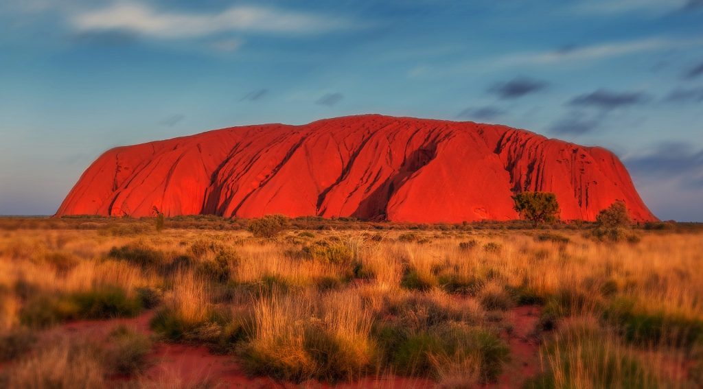
Uluru, (we will not be using the term ‘Ayers Rock’) is a sandstone monolith in the Northern Territory in Australia. It’s a geological wonder in its own right, but it’s also a cultural and spiritual icon for the indigenous Anangu people. This article explores the formation and geological characteristics of Uluru, its cultural importance, its troubled history with non-indigenous people, and the journey towards its return to indigenous ownership.
How a monolith forms
Uluru’s formation dates back 550 million years. During the late Neoproterozoic and early Cambrian periods, at this time life was just getting started with the world famous Cambrian explosion. The region was part of an inland sea. Over time, sediments were washed from land, through river systems, and found their way to this sea. Through the eons the relentless depositing of minute amounts of sand and gravel compressed into sandstone and conglomerate rock formations.
Around 400 million years ago, just as the first insects began to appear in the fossil record, tectonic activity began to shift these rock layers. The crust buckled and folded as two converging plates pushed relentlessly together, creating large folds and faults known as an inselberg or “island mountain.” Eventually, one of these inselbergs broke the surface and was exposed to the elements. This is how the great monolith came into being. If you look closely, you can still sort of make out the rock strata running diagonally down the face of Uluru as erosion has continued to weather away the softer rock
Size and Shape
Uluru is the second largest monolith in the world, behind Mount Augustus, also in Australia. It stands 348 meters (1,142 feet) high. Much like an iceberg, most of its bulk lies underground. It has a circumference of about 9.4 kilometers (5.8 miles). The rock is 2.2 kilometers (1.4 miles) long and 1.6 kilometers (1 mile) wide. Its surface is characterized by its deep grooves, ridges, and caves formed by erosion.
The rock’s striking red color comes from its iron oxide coating, which contrasts with the non-weathered grey rock beneath. The colors of Uluru change dramatically at different times of the day and year, ranging from deep reds and purples at sunrise and sunset to softer ochres and browns during the day.
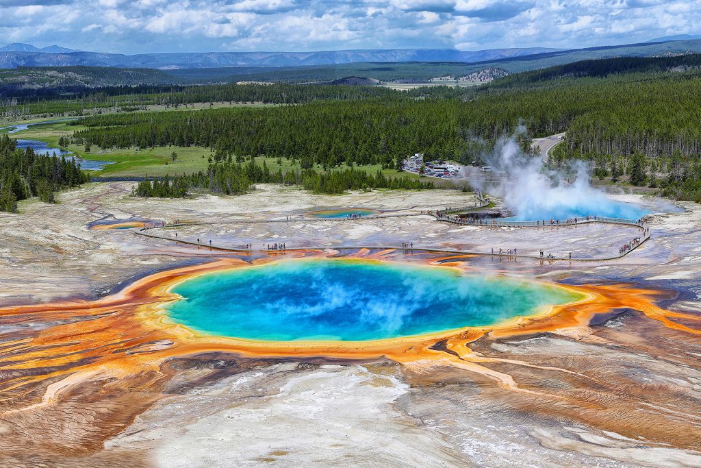
Similar Formations Around the World
While Uluru is unique in many ways, there are similar formations around the world that share certain geological characteristics:
Kata Tjuta (The Olgas):
Located about 25 kilometers (16 miles) west of Uluru, Kata Tjuta is a group of large, domed rock formations. Like Uluru, they are composed of conglomerate rock and hold significant cultural importance for the Anangu people.
Devils Tower (Wyoming, USA):
This monolithic igneous formation rises 386 meters (1,267 feet) above the surrounding terrain. It is composed of phonolite porphyry and has significant cultural importance for several Native American tribes.
Sigiriya (Sri Lanka):
Also known as Lion Rock, Sigiriya is an ancient rock fortress. Rising 200 meters (660 feet) above the jungle, it is composed of hardened magma from an extinct volcano and is surrounded by the remnants of gardens and palaces.
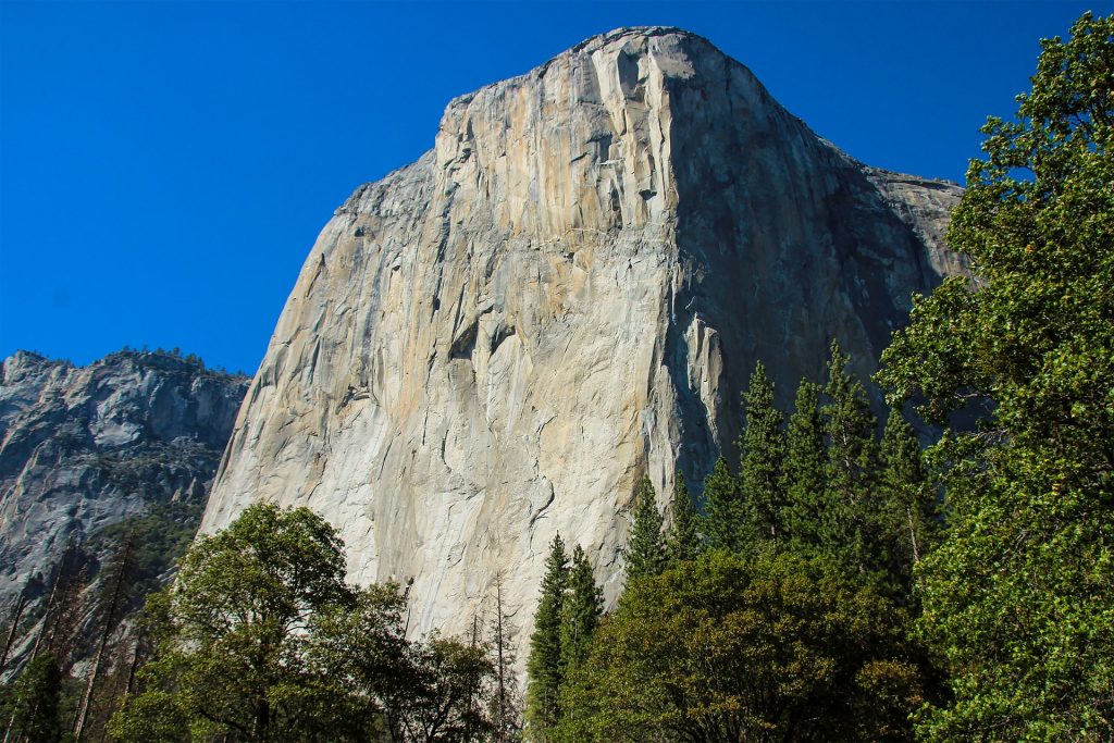
El Capitan (California, USA):
Perhaps one of the few monoliths that rival Uluru in recognizability. This vertical rock formation in Yosemite National Park is made of granite and rises about 900 meters (3,000 feet) from the valley floor. It is a popular destination for rock climbers.
Cultural importance to the Anangu people
For the Anangu, the traditional owners of Uluru, the rock is a sacred site. It is intertwined with Tjukurpa, often translated as “Dreamtime” or “the Dreaming,” which encompasses the spiritual beliefs, law, and history of the Anangu people. Uluru is considered a living cultural landscape, and its features are linked to ancestral beings who traveled across the land, creating the world and laying down laws and customs.
The Anangu have a deep spiritual connection to Uluru, and it features prominently in their creation stories and rituals. The rock’s various caves, waterholes, and rock formations are considered sacred sites are associated with different ancestral beings, rituals, ceremonies and stories
Cultural Practices and Knowledge
The Anangu people have traditionally used the land around Uluru for hunting, gathering, and ceremonies. Their knowledge of the local flora and fauna, weather patterns, and land management practices has been passed down through generations. This traditional ecological knowledge is essential for maintaining the health of the landscape and preserving biodiversity.
There are several sites within and around Uluru that have gender specific roles in Anangu culture. There are strict protocols within the culture that the Anangu men and women do not interfere with each other’s sacred sites and cultural practices. The sites are not widely known and the exact location of virtually all of the sites are known only to the Anangu people.
The Anangu people have a rich oral history with stories of their ancestors, their travels and of the history of the land. Much of the history of the Anangu people can also be found in cave art found throughout Uluru. The Anangu people have a distinctive dot-painting style. This tradition continues to this day, with Anangu artists continuing to create artworks depicting Tjukurpa stories.
Initial European Discovery and Naming
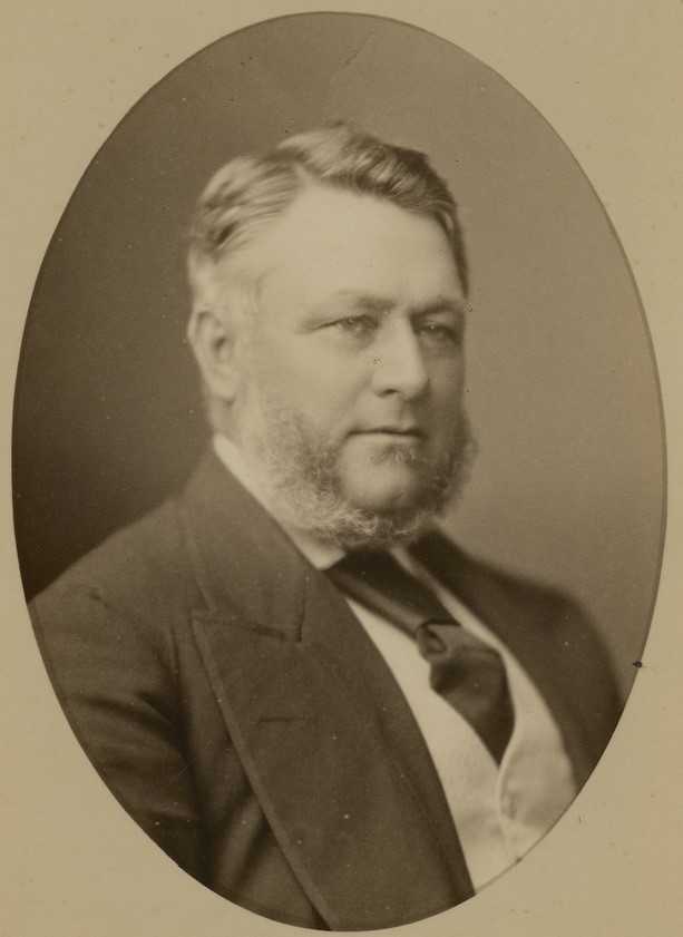
After many thousands of years of aboriginal stewardship of Uluru the South Australian government was on the hunt for new lands to colonise. In 1873, the South Australian government was looking for new pasture land, or areas for future development. They engaged William Gosse, the British born explorer, to map a large region of Australia to the south of Alice springs. He departed Alice springs on 21st of April 1873 with a crewe of 7 people – including 3 Afghans and an aboriginal boy named Moses.
On 19th June of that year, Uluru was first sighted by Europeans. Gosse named it Ayers Rock in honor of Sir Henry Ayers, the Chief Secretary of South Australia. This name became the commonly used term for Uluru in Western contexts, though the indigenous name has always been recognized by the Anangu people. The company spent some time exploring the monolith and documented several sites that were occupied by aboriginal people. They also became the first people of European descent to climb the monolith.
The Stolen Land
Thanks to the efforts of Gosse and others, In the late 19th and early 20th centuries, European settlers were migrating south. As they did so, they encroached on the land traditionally owned by the Anangu people.
In 1920, the Australian government declared the entirety of the land around Uluru as pastoral lands. The establishment of cattle stations disrupted traditional land use and led to significant changes in the local ecosystem. The Anangu were marginalized and their cultural practices were restricted.
In 1958, the area around Uluru and Kata Tjuta was declared a national park, initially named Ayers Rock–Mount Olga National Park. The creation of the park led to further displacement of the Anangu people and restricted their access to sacred sites. The designation of the site as a national park led to a rapid growth of tourism in the area, with thousands of people a year climbing the sacred rock. To cater for this growth, tourism infrastructure was built, often very close to Uluru. Motels, campsites and other attractions. All objections from the Anangu people were ignored.
The fightback
Throughout the 20th century it was becoming increasingly clear that the Aboriginal people had been horribly mistreated (and in many respects, continue to be so to this day). The 1970’s and 1980’s saw an increasing cacophony of voices demanding that the situation be addressed. In 1979, the Anangu people formally petitioned the Australian government for the return of Uluru and Kata Tjuta to the Anangu people.
After many years of delicate negotiations, in a landmark decision on October 26, 1985, the Australian government officially returned the ownership of Uluru and Kata Tjuta to the Anangu people. The handback ceremony was a significant moment in the recognition of indigenous rights in Australia. As part of the agreement, the Anangu leased the land back to the Australian government for 99 years to be jointly managed as a national park.
The park was renamed Uluru-Kata Tjuta National Park, and a Board of Management was established, comprising a majority of Anangu members and representatives from the Australian government. This joint management model aims to integrate traditional knowledge and modern conservation practices.
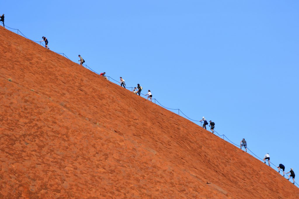
The End of Climbing Uluru
Since the very first European to see Uluru became the very first European to climb Uluru, climbing Uluru was a popular activity for tourists. However, this practice was deeply disrespectful to the Anangu people. The climbing route follows a traditional Dreaming track, and the Anangu repeatedly expressed their wishes for the practice to stop.
After years of advocacy by the Anangu people and discussions with the national park authorities, it was announced in 2017 that climbing Uluru would be permanently banned. The ban came into effect on October 26, 2019, exactly 34 years after the land was returned to the Anangu. The decision was widely supported by both the Anangu community and the broader Australian public.
The closure of the climb has allowed for a greater focus on culturally respectful and environmentally sustainable tourism. Visitors are encouraged to engage with the rich cultural heritage of the Anangu people through guided tours, educational programs, and cultural experiences.
Uluru Today: Tourism and Conservation
Uluru-Kata Tjuta National Park is one of Australia’s most popular tourist destinations, attracting over 250,000 visitors annually. The park offers a range of activities and experiences that allow visitors to appreciate the natural beauty and cultural significance of the area.
Visitors can join guided tours led by Anangu guides, who share their knowledge of the land, its cultural significance, and traditional practices. These tours provide a deeper understanding of the spiritual connection between the Anangu people and Uluru.
The park’s Cultural Center offers exhibits, displays, and interactive experiences that educate visitors about Anangu culture, history, and the natural environment. It serves as an important resource for promoting cross-cultural understanding and respect.
The park features several well-maintained trails that allow visitors to explore the area on foot. The Mala Walk, Kuniya Walk, and the base walk around Uluru are popular options that offer stunning views and insights into the rock’s cultural and geological significance.
The joint management of Uluru-Kata Tjuta National Park focuses on preserving the area’s natural and cultural heritage. Key conservation efforts include:
Traditional fire management practices, known as patch burning, are used to maintain the health of the landscape and reduce the risk of large-scale wildfires. These practices promote biodiversity and protect important habitats.
The park is home to a variety of native species, including some that are endangered. Species such as the Spinifex Hopping Mouse, Thorny Devil reptile, Australian Bustard and Desert Tree Frog all call the park home. Conservation programs aim to protect and restore these populations through habitat management, monitoring, and research.
Protecting and preserving cultural sites, including rock art and sacred areas, is a priority. This involves ongoing collaboration with the Anangu community to ensure that their cultural practices and knowledge are respected and maintained.
Challenges and Future Directions
While significant progress has been made in recognizing and respecting the cultural significance of Uluru, challenges remain. These include managing the impacts of tourism, addressing environmental threats such as climate change, and ensuring that the Anangu people have a strong voice in the ongoing management of their land.
Efforts continue to develop and promote tourism practices that minimize environmental impact and support the local community. This includes encouraging longer stays, promoting lesser-known areas of the park, and enhancing visitor education.
The local governing body continues to implement strategies to mitigate the effects of climate change, such as increasing the resilience of native vegetation and managing water resources sustainably.
There is also a raft of grassroots initiatives that empower the Anangu people to maintain and share their cultural heritage, including language programs, cultural education, and the development of cultural enterprises.
Final Thoughts
Uluru stands as a symbol of Australia’s natural beauty and cultural heritage. Its formation over millions of years, its significance to the Anangu people, and the journey towards its recognition and protection as a sacred site reflect the complex interplay between nature, culture, and history.
Whilst there is still a long way to go, the return of Uluru to its traditional owners and the end of the climbing practice are significant milestones in the effort to honor and respect indigenous rights and cultural heritage. As a UNESCO World Heritage Site, Uluru-Kata Tjuta National Park continues to inspire awe and reverence, attracting visitors from around the world who seek to connect with its profound beauty and cultural significance.
Through sustainable tourism and collaborative conservation efforts, Uluru’s legacy will be preserved for future generations, ensuring that this iconic monolith remains a place of wonder, learning, and spiritual reflection.